
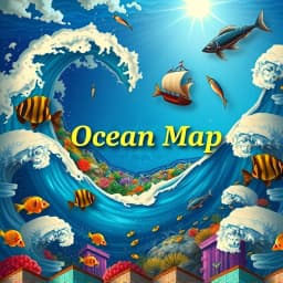
Ocean Map Illustration Generator
Find this useful? Bookmark ( CTRL/CMD + D ) for quick access!
Try an example:
Educational Ocean Maps
Fantasy World Maps
Marine Conservation Illustrations
Adventure Game Maps
Historical Sea Route Maps
Artistic Ocean Landscapes
Press Enter to send. Shift+Enter for New line
Explore Similar Tools


Recent Generations
Taco Bar Party Ideas
the amount paid directly to you. Yes it is possible in future cases to request direct payment to the provider, Rephrase and give me polished email.
Claim Email Template
we have processed the claim as per the attachments in the claim submission we have processedthe invoice for Saul Holding. We dont have invoice for the Salofalk.
Claim Email Template
this additional information is very important. this adiitional information was requested by our clinical team. Without clinical review claim not be paid so please share the below additional information
Ocean Map Illustration Generator
The Ocean Map Illustration Generator is a cutting-edge AI-powered tool designed to create stunning and detailed ocean map illustrations effortlessly. This innovative solution combines advanced machine learning algorithms with user-friendly features to deliver visually captivating maps that are perfect for various applications.
Key Capabilities
- Customizable Map Designs with a variety of styles and themes, allowing users to create unique ocean maps tailored to their specific needs.
- High-Resolution Outputs enabling the generation of professional-quality illustrations suitable for print and digital use.
- Interactive Features that allow users to add annotations, labels, and other elements, enhancing the storytelling aspect of each map.
- Fast Processing Time ensuring that users can generate beautiful ocean maps in just a few clicks, saving valuable time and effort.
Who It's For
Designed for graphic designers, educators, and marine enthusiasts, the Ocean Map Illustration Generator excels in creating visually appealing maps for educational materials, presentations, and artistic projects. Whether you're illustrating oceanic research or crafting a unique piece of art, this tool streamlines your workflow and enhances creativity.
Why Choose Ocean Map Illustration Generator
What sets the Ocean Map Illustration Generator apart is its intuitive interface and powerful customization options, making it the ideal solution for anyone looking to create stunning ocean maps without the need for extensive design skills.
Ready to transform your ocean mapping projects? Start using the Ocean Map Illustration Generator today and experience the difference in your creative process!
Enhance Your Work with Ocean Map Illustration Generator
Leverage the power of AI to streamline your tasks with our Ocean Map Illustration Generator tool.
Customizable Map Styles
Choose from a variety of styles and themes to create unique ocean maps tailored to your preferences.
Multi-Layered Illustrations
Generate complex ocean maps with multiple layers, including topography, marine life, and environmental data.
Interactive Visualization
Explore your ocean maps interactively, allowing for zooming, panning, and detailed examination of specific areas.
How Ocean Map Illustration Generator Works
Discover the simple process of using Ocean Map Illustration Generator to improve your workflow:
01
Upload Your Map Data
Begin by uploading your geographical data files to the Ocean Map Illustration Generator.
02
Select Visualization Styles
Choose from a variety of illustration styles and color palettes to customize your ocean map.
03
AI Rendering
Our AI processes your data and generates stunning ocean map illustrations based on your selections.
04
Download Your Illustration
Once the rendering is complete, download your high-quality ocean map illustration for use.
Use Cases of
Ocean Map Illustration Generator
Explore the various applications of Ocean Map Illustration Generator in different scenarios:
Marine Conservation Planning
Create detailed ocean maps to identify critical habitats and inform conservation strategies for marine ecosystems.
Fisheries Management
Generate visualizations of fish populations and migration patterns to support sustainable fishing practices and regulatory decisions.
Coastal Development Projects
Illustrate oceanographic data to assess the impact of coastal development on marine environments and inform planning processes.
Climate Change Impact Studies
Visualize the effects of climate change on ocean currents and temperatures to support research and policy-making efforts.
Who Benefits from Ocean Map Illustration Generator?
AI-Powered Efficiency
From individuals to large organizations, see who can leverage Ocean Map Illustration Generator for improved productivity:
Marine Biologists
Visualize oceanic ecosystems and track changes in marine biodiversity.
Environmental Scientists
Analyze oceanographic data to assess environmental impacts and conservation efforts.
Urban Planners
Integrate ocean data into coastal development plans to ensure sustainable growth.
Educators
Create engaging educational materials that illustrate oceanic concepts and phenomena.
Frequently Asked Questions
What types of ocean maps can the Ocean Map Illustration Generator create?
The Ocean Map Illustration Generator can create a variety of ocean maps, including topographic maps, bathymetric maps, and thematic maps that highlight specific oceanographic features.
Is there a limit to the number of illustrations I can generate?
No, there is no limit to the number of illustrations you can generate. However, please be aware that excessive usage may lead to longer processing times during peak hours.
Can I customize the illustrations generated by the tool?
Yes, users can customize various aspects of the illustrations, including color schemes, labels, and the inclusion of specific oceanographic data to suit their needs.
What file formats are available for downloading the generated maps?
The Ocean Map Illustration Generator allows you to download maps in multiple file formats, including PNG, JPEG, and PDF, making it easy to use them for presentations or publications.
Is there a tutorial available for new users of the tool?
Yes, we provide a comprehensive tutorial and user guide that walks you through the features and functionalities of the Ocean Map Illustration Generator, ensuring you can make the most of the tool.