
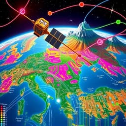
Satellite Map Illustration Generator
Find this useful? Bookmark ( CTRL/CMD + D ) for quick access!
Try an example:
Urban Planning Visualization
Environmental Impact Assessment
Disaster Response Mapping
Tourism Promotion Graphics
Real Estate Development Analysis
Agricultural Land Use Mapping
Press Enter to send. Shift+Enter for New line
Explore Similar Tools


Recent Generations
Taco Bar Party Ideas
the amount paid directly to you. Yes it is possible in future cases to request direct payment to the provider, Rephrase and give me polished email.
Claim Email Template
we have processed the claim as per the attachments in the claim submission we have processedthe invoice for Saul Holding. We dont have invoice for the Salofalk.
Claim Email Template
this additional information is very important. this adiitional information was requested by our clinical team. Without clinical review claim not be paid so please share the below additional information
Satellite Map Illustration Generator
The Satellite Map Illustration Generator is a cutting-edge AI-powered tool designed to create stunning, high-quality satellite map illustrations effortlessly. By leveraging advanced algorithms and satellite imagery, this innovative solution enables users to visualize geographical data in a visually appealing manner, making it perfect for presentations, reports, and creative projects.
Key Capabilities
- Customizable Map Designs with various styles and color palettes to suit your project needs.
- High-Resolution Outputs ensuring that your illustrations maintain clarity and detail, even when zoomed in.
- User-Friendly Interface that simplifies the map creation process, allowing users of all skill levels to generate professional-quality illustrations quickly.
- Integration with GIS Data enabling users to incorporate real-time geographical information for enhanced accuracy and relevance.
Who It's For
The Satellite Map Illustration Generator is ideal for professionals in fields such as urban planning, environmental science, and marketing. Whether you're creating a detailed report for stakeholders or designing engaging content for social media, this tool streamlines your workflow and enhances productivity.
Why Choose Satellite Map Illustration Generator
What sets the Satellite Map Illustration Generator apart is its ability to combine artistic design with precise geographical data, making it the perfect solution for anyone looking to create impactful visualizations that tell a story.
Ready to transform your mapping projects? Start using the Satellite Map Illustration Generator today and experience the difference in your visual storytelling!
Enhance Your Work with Satellite Map Illustration Generator
Leverage the power of AI to streamline your tasks with our Satellite Map Illustration Generator tool.
Customizable Map Styles
Choose from a variety of map styles and color palettes to create unique satellite illustrations tailored to your needs.
High-Resolution Imagery
Generate stunning, high-resolution satellite images that capture intricate details for professional presentations and reports.
Multi-Layered Visualization
Overlay multiple data layers on your satellite maps, allowing for comprehensive analysis and enhanced storytelling.
How Satellite Map Illustration Generator Works
Discover the simple process of using Satellite Map Illustration Generator to improve your workflow:
01
Upload Your Satellite Data
Begin by uploading your satellite imagery or geospatial data to the platform for processing.
02
Select Mapping Parameters
Choose the specific parameters and features you want to highlight in your satellite map illustration.
03
AI Illustration Generation
Our AI tool processes the data and generates a detailed satellite map illustration based on your selections.
04
Download Your Illustration
Once the illustration is complete, download your high-resolution satellite map for further use.
Use Cases of
Satellite Map Illustration Generator
Explore the various applications of Satellite Map Illustration Generator in different scenarios:
Urban Planning
Utilize satellite map illustrations to visualize urban development projects, assess land use, and plan infrastructure improvements.
Environmental Monitoring
Generate satellite maps to track changes in land cover, deforestation, and natural resource depletion for environmental conservation efforts.
Disaster Response Planning
Create detailed satellite illustrations to aid in disaster preparedness and response strategies, identifying vulnerable areas and resource allocation.
Agricultural Management
Leverage satellite imagery to monitor crop health, optimize irrigation practices, and enhance yield predictions for better agricultural outcomes.
Who Benefits from Satellite Map Illustration Generator?
AI-Powered Efficiency
From individuals to large organizations, see who can leverage Satellite Map Illustration Generator for improved productivity:
Urban Planners
Visualize land use and infrastructure to enhance city development strategies.
Environmental Scientists
Analyze geographical data to monitor environmental changes and conservation efforts.
Real Estate Developers
Assess property locations and market trends to make informed investment decisions.
Content Creators
Generate visually appealing satellite imagery for educational and promotional content.
Frequently Asked Questions
What types of satellite imagery can the generator create?
The Satellite Map Illustration Generator can create various types of satellite imagery, including topographic maps, vegetation maps, urban planning maps, and more, tailored to your specific needs.
Is there a limit to the area I can generate maps for?
While there is no strict limit, the processing time may vary depending on the size of the area. For very large areas, we recommend breaking them down into smaller sections for optimal performance.
Can I customize the generated maps?
Yes, the tool allows for customization options such as color schemes, labels, and overlays to suit your specific requirements and preferences.
What file formats are available for the generated maps?
The Satellite Map Illustration Generator supports multiple file formats, including PNG, JPEG, and GeoTIFF, allowing you to choose the best format for your use case.
Do I need any special software to use the generator?
No special software is required. The Satellite Map Illustration Generator is a web-based tool, accessible through any modern web browser, making it easy to use without additional installations.